Trends.Earth: Monitoring Land Degradation and Restoration for the UNCCD in Colombia
Trends.Earth: Monitoring Land Degradation and Restoration for the UNCCD in Colombia

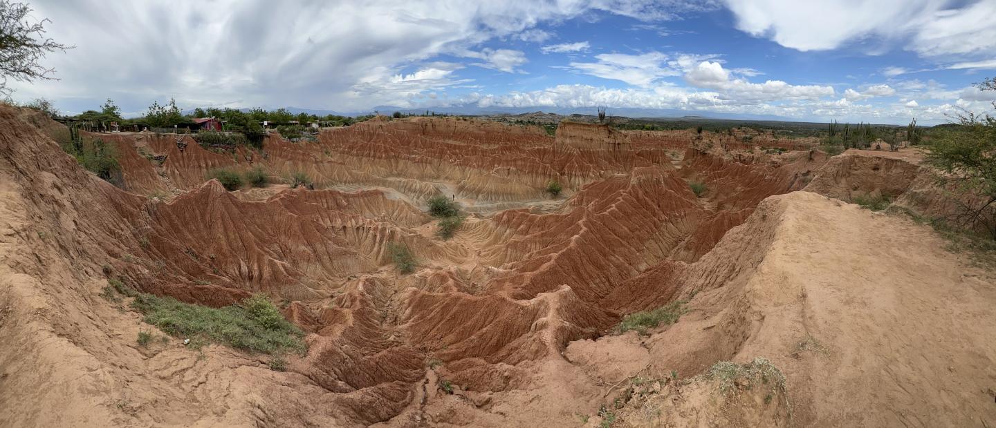
Land degradation is a growing global problem. Degraded land – defined as land with diminished productivity – threatens livelihoods, increases food prices, drives losses in biodiversity and ecosystem services, and contributes to climate change. In Colombia, cattle farming and mineral extraction are primary drivers of degradation, hindering the country’s voluntary goal of restoring 100,000 hectares of degraded land by 2030. Accurately monitoring land degradation is key to Colombia’s plans for setting and achieving national Land Degradation Neutrality (LDN) targets.
Colombia joined the LDN Target Setting Programme (TSP) in 2016. The United Nations Convention to Combat Desertification (UNCCD) requires Colombia to report its progress towards LDN using the United Nations Sustainable Development Goal (SDG) 15.3.1 indicator: the proportion of degraded land over total land area. According to the standardized methodology outlined in the UNCCD’s Good Practices Guidance document, land degradation is calculated using three sub-indicators: trends in land cover, land productivity, and carbon stocks.
To perform the analysis required to show progress on the SDG 15.3.1 indicator, Colombia’s Ministry of Environment and Sustainable Development (MADS) used Conservation International’s Trends.Earth tool. Trends.Earth is a free and open-source tool that applies the UNCCD best practices methodology and produces results compatible with the UNCCD’s Performance Review and Implementation System (PRAIS4) reporting platform.
In 2018, Colombia established a national baseline by analyzing land degradation from 2000-2015. The analysis categorized land as degraded, stable, or improving. Updated results will be re-calculated and reported every five years through 2030 – the UNCCD’s target date to achieve LDN. For the most recent reporting period of 2015-2019, Colombia used Trends.Earth to report progress towards SDG 15.3.1 and estimate indicators for other UNCCD strategic objectives, such as the proportion of the population exposed to land degradation disaggregated by sex and the degree of drought vulnerability. In addition to reporting to the UNCCD, Colombia is using the national maps of land degradation, erosion, and salinization that it produces with Trends.Earth to prioritize areas for intervention.
Colombia was chosen as a pilot country for the Global Environment Facility-funded project “Strengthening Land Degradation Neutrality data and decision-making through free and open access platforms.” In this project, Conservation International is partnering with the World Overview on Conservation Technologies and Approaches (WOCAT), the UN Food and Agriculture Organization (FAO), and the Land Potential Knowledge System (LPKS) mobile app to support users in leveraging high resolution satellite imagery, data on drought and socioeconomic risk factors, and field-level information to contextualize land degradation at multiple scales via Trends.Earth. This will allow for the verification of degradation and improvement trends and facilitate the restoration planning process in Colombia.
Sources:
- Trends.Earth Documentation: General information — Trends.Earth 1.0.7 documentation
- Trends.Earth General Fact Sheet: Trends.Earth_Fact_Sheet.pdf
- Trends.Earth Technical Fact Sheet: Trends.Earth_Fact_Sheet_Technical.pdf
- Tools for LDN Project Website (this is the project focused on improving and expanding the capabilities of Trends.Earth, rather than using existing Trends.Earth to monitor any specific location): The Project — Tools4LDN
- GEF website on land degradation neutrality (what LDN is and stats on how much of the world’s land is degraded): Land Degradation | GEF (thegef.org)
- 2019 IPCC Special Report on Climate Change & Land – Ch. 4: Land Degradation (what LDN is and stats on how much of the world’s land is degraded): Chapter 4 : Land Degradation — Special Report on Climate Change and Land (ipcc.ch)
- 2019 IPCC Special Report on Climate Change & Land Summary for Policymakers: Summary for Policymakers — Special Report on Climate Change and Land (ipcc.ch)
- 2018 Colombia LDN Commitments (Spanish): S-GAA-18-003230 - Vigencia: Indefinida (unccd.int)
- 2018 Colombia LDN Country Report (Spanish): 1 Introducción (unccd.int)
- Colombia 20x20 page: Colombia | Initiative 20x20
- OECD 2014 Colombia Environmental Performance Review (what causes land degradation in Colombia): Colombia Highlights english web.pdf (oecd.org)
- UNCCD blog post on Colombia’s efforts towards SDG 15.3 (stats on how much land in Colombia is degraded/vulnerable to degradation): Colombia advances on the SDG 15 agenda on “life on land” through the implementation of the National Policy for Sustainable Soil Management | UNCCD
- 2014 World Bank document on Republic of Colombia Mitigating Environmental Degradation to Foster Growth and Reduce Inequality (super detailed stats on land degradation in Colombia and estimates on how much that costs; haven’t really used yet): World Bank Document
- Colombia’s SDG Goals: Colombia | Knowledge Hub (unccd.int)
- Info about the PRAIS4 Reporting Platform: PRAIS 4 reporting platform is live | UNCCD
- About UNCCD Good Practices Methodology: New UNCCD guides on land degradation & drought reporting | UNCCD
- UNCCD Best Practices Methodology Document: UNCCD_GPG_SDG-Indicator-15.3.1_version2_2021.pdf

