MapBuilder: Community-Led Monitoring in Suriname
MapBuilder: Community-Led Monitoring in Suriname

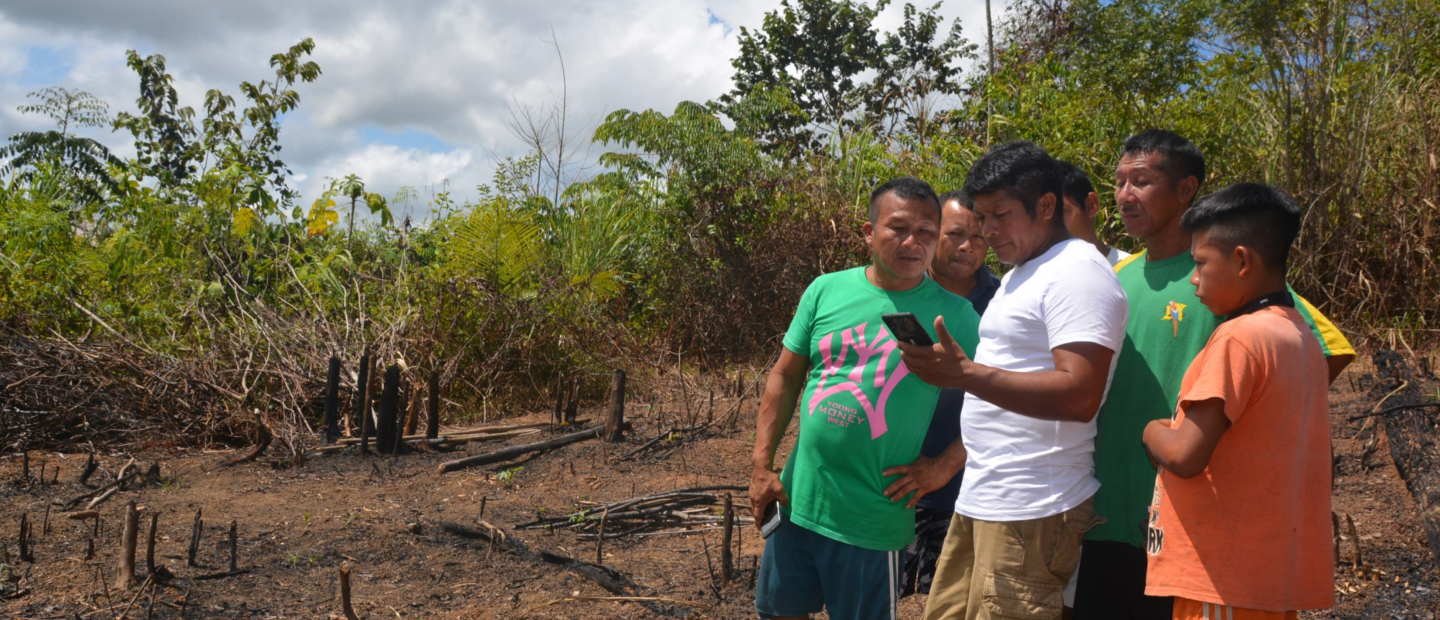
The MapBuilder tool is being used by rangers from Indigenous and Maroon (Afro-descendant) communities in Suriname to monitor forest and river ecosystems and to inform management decisions by community authorities. The Amazon Conservation Team’s Suriname office (ACT-Suriname) works with seven Indigenous communities and eleven Maroon communities that claim and manage large territories in the central and southern half of the country.
The traditional local authorities in those communities make decisions about ecosystem management based on cultural practices for land use and communities’ life plans. Monitoring of deforestation and forest changes, water quality, and plant and animal species is essential for these management decisions. Monitoring is often conducted by community rangers. Since 2018, ACT-Suriname has been training community rangers to use MapBuilder to aggregate and analyze the specific data communities need to protect and sustainably manage their forests.
MapBuilder enables the community rangers and authorities to collect data about the monitoring concerns that are most relevant to their particular territories and to layer those data over forest loss and gain data from Global Forest Watch (GFW). Community rangers are equipped with smartphones, tablets, and laptops. They can also collect data offline and manually add it to MapBuilder. The rangers are primarily monitoring forest change and forest loss. Rangers also monitor water quality in rivers, wildlife as an indicator of ecosystem health, and forest species that are important for food, medicines, or other livelihood needs. Specific indicators vary by community—some communities may be more focused on monitoring logging activities or territorial boundaries, while others on river health or biodiversity.
In all cases, after collecting the data, community rangers input it in MapBuilder and combine it with forest change layers from GFW. This combination of data allows traditional local authorities to make decisions about territorial management that align with identified biocultural needs and to respond quickly when changes are detected, such as deforestation or decreased water quality caused by logging or mining. Community authorities may then seek support from ACT-Suriname, government agencies, or other organizations that can address threats. For example, in one community forest where there is logging activity, rangers are trained to use MapBuilder to monitor the forest to see if logging companies are complying with regulations. Regulations that rangers monitor include the size and types of trees that can be harvested and that loggers leave the unit after harvesting to allow for natural restoration. If concerns about logging activity arise, ACT-Suriname will support communities in reaching out to the government.
ACT-Suriname and the community rangers are expanding the use of monitoring through MapBuilder to support other initiatives. Rangers are using camera trap data, which can be input to MapBuilder, to track jaguars and other keystone wildlife species to monitor populations and ecosystem health. Non-timber forest products (NTFPs) such as tea, honey, hot peppers, and jewelry are important sources of income for some Indigenous communities in remote regions of southern Suriname, and MapBuilder is being used to inventory and monitor NTFP species to foster sustainable use. Communities also use MapBuilder to map and monitor medicinal plant species to facilitate transmission of traditional knowledge and support internal community education.
Monitoring that supports ecosystem management helps Indigenous and Maroon communities demonstrate their stewardship of forests and reinforce claims to land titles. The government of Suriname is in the process of recognizing Indigenous, tribal, or collective rights and is attempting to strengthen enforcement of land use and planning policies. ACT is working with communities in southern Suriname to advocate for formal recognition of collective land rights and supporting the government through this process. Mapping, delineating, and monitoring territories—through the use of MapBuilder, among other activities—helps to advance efforts for recognition and enforcement. Secure land titles will support Indigenous and Maroon communities in managing, monitoring, conserving, and restoring ecosystems on their territories.
In addition, at the regional level, ACT has been working with Indigenous organizations, local communities, and government agencies to consolidate a biocultural corridor across the eastern Guiana Shield that links Indigenous-managed landscapes and protected areas and connects the people who care for those territories. The consolidation of this corridor requires jointly developing monitoring and management strategies that protect the forest long-term and enable it to be restored when disturbances occur. For both the recognition of the collective rights of local communities and the consolidation of the biocultural corridor, community-led monitoring and management is critical, and MapBuilder is one tool that supports these important efforts.
Read more about ACT-Suriname’s work with Indigenous and Maroon communities here.


